View as:
Standard
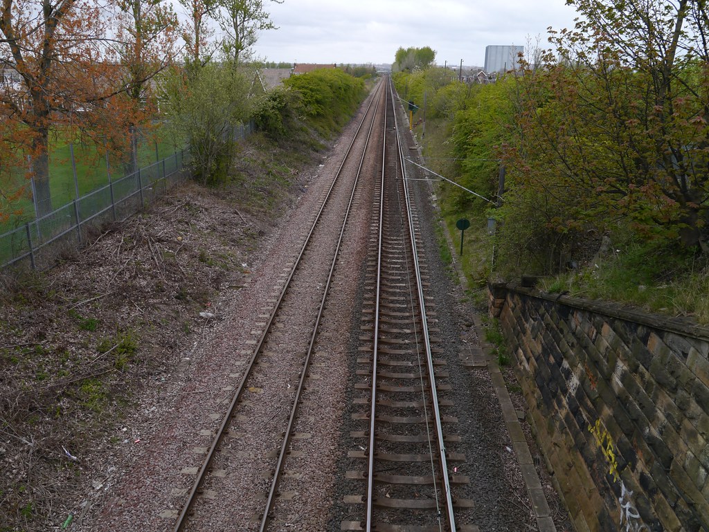
Commencement
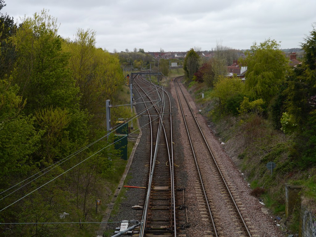
Junction near Pelaw Junction
Termination
End of Line beyond South Shields Station
Zero Point
Near Pelaw Junction (98m 15ch on Leeds Northern)
NER Abbreviation
So S Br
NER Line Name
South Shields Branch
NER Line Number
N119
Line Diagram
| Mileage | No. | Details | ||
|---|---|---|---|---|
| 0m 00ch |
Pelaw Junction
|
|||
| 0m 10ch | 1 |
Footbridge
|
||
| 0m 39ch | 2 |
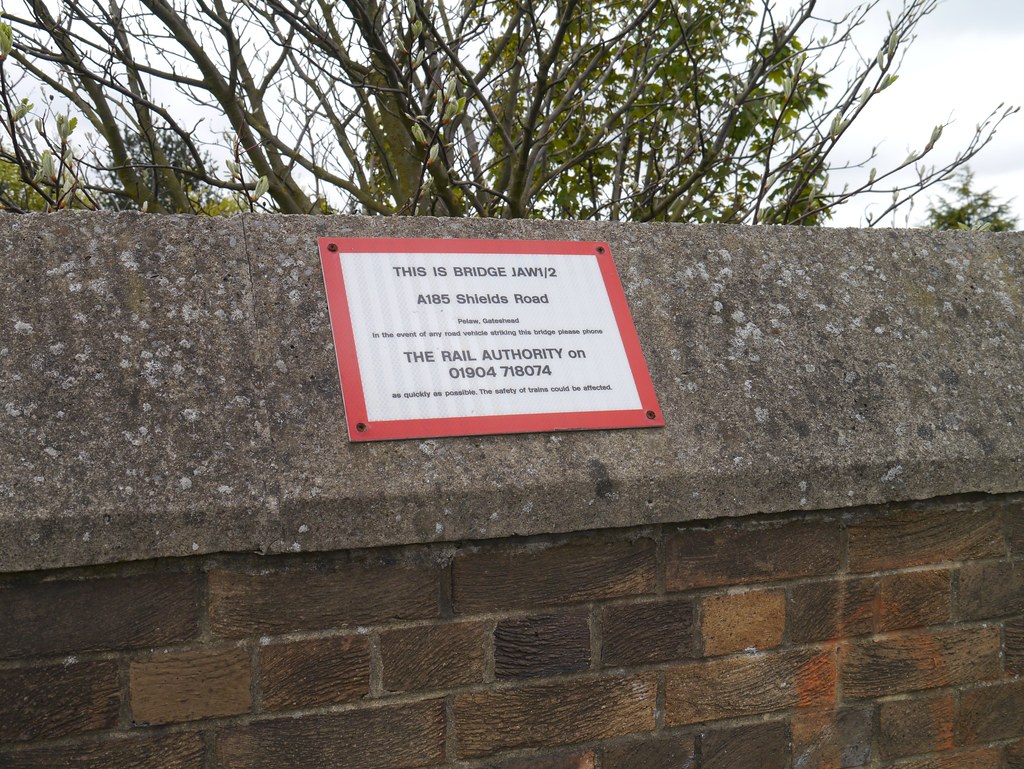
A185 Road
    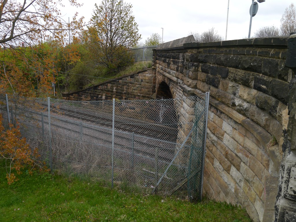  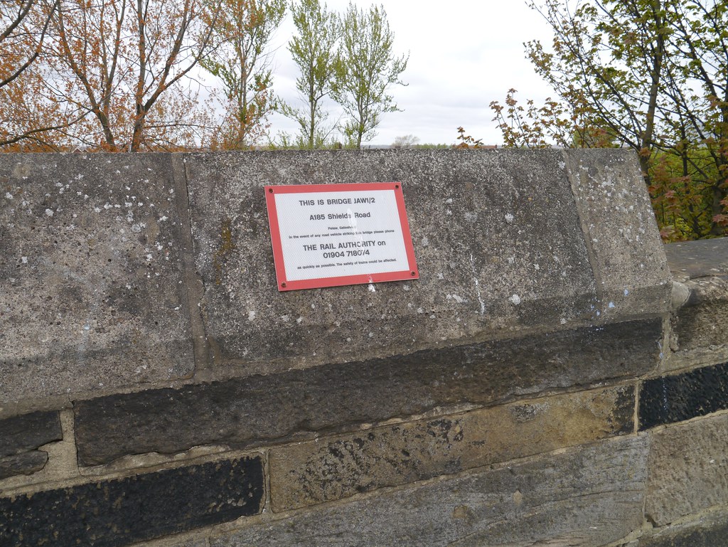 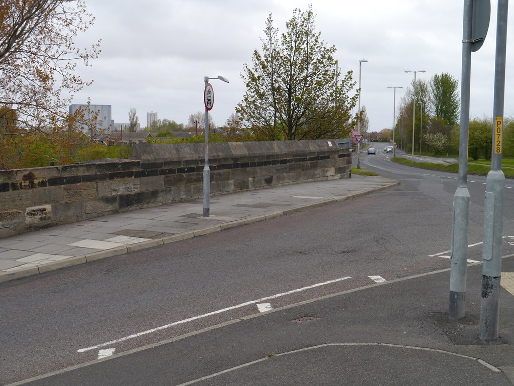  |
||
| 0m 59ch |
Occupation Crossing
|
|||
| 1m 00ch |
Graham's Crossing
|
|||
| 1m 01ch |
Graham's Crossing Gate Signal Box
|
|||
| 1m 13ch |
South Drive Crossing
|
|||
| 1m 30ch |
Old Subway
Filled in
|
|||
| 1m 36ch | 2A |
Cut Throat Dene
|
||
| 1m 36ch | 2B |
Reyrolle Subway
|
||
| 1m 37ch |
Hebburn West Signal Box
|
|||
| 1m 38ch |
Tharsis Copper Works
|
|||
| 1m 38ch |
Reyrolle & Co Ltd Siding
|
|||
| 1m 38ch |
Occupation Crossing
|
|||
| 1m 53ch |
Sprout & Marley's Siding
|
|||
| 1m 59ch |
Goods Shed
|
|||
| 1m 62ch |
Hebburn Signal Box
|
|||
| 1m 63ch | 3 |
Station Road
|
||
| 1m 63ch | 4 |
Footbridge
|
||
| 1m 66ch |
Hebburn
TWM rebuilding left only up platform on original site (366)
|
|||
| 1m 71ch |
Alby Carbide Co's Siding
|
|||
| 1m 73ch |
Electric Power Station Siding
|
|||
| 2m 04ch | 4A |
Footbridge
|
||
| 2m 41ch |
Swan Hunter Siding
|
|||
| 2m 42ch | 5 |
High Lane Row / Black Road
|
||
| 2m 42ch | 6 |
Hebburn Colliery Wagonway Bridge
|
||
| 2m 44ch |
Pontop Signal Box
|
|||
| 2m 44ch |
Pontop & Jarrow Railway
|
|||
| 2m 55ch |
Foster & Wilson Lead Works
|
|||
| 2m 56ch | 7 |
>Pontop and Jarrow Railway
|
||
| 2m 58ch | 8 |
Pontop and Jarrow Railway
|
||
| 2m 61ch | 9 |
Culvert
|
||
| 2m 66ch |
Palmer's Works
|
|||
| 2m 71ch | 10 |
Hill Street
|
||
| 2m 76ch |
Goods Shed
|
|||
| 3m 01ch | 11 |
Jarrow Station Footbridge
|
||
| 3m 03ch | 12 |
Footbridge
|
||
| 3m 03ch |
Jarrow
|
|||
| 3m 04ch |
Jarrow Signal Box
|
|||
| 3m 22ch | 13 |
Albert Road
|
||
| 3m 29ch | 14 |
Monkton Terrace
|
||
| 3m 36ch |
Shell Mex Co's Siding
|
|||
| 3m 41ch | 16 |
Tyne Tunnel Approach bridge
|
||
| 3m 46ch | 15 |
Occupation Road
|
||
| 3m 46ch | 16 |
River Don
Renumbered 16A
|
||
| 3m 61ch |
Occupation Crossing
|
|||
| 3m 67ch | 17 |
Lake House Farm Bridge
|
||
| 3m 74ch | 18 |
Culvert
|
||
| 3m 76ch | 19 |
Occupation Road
|
||
| 4m 09ch |
Foot Crossing
|
|||
| 4m 16ch | 20 |
Cleveland Place / Monkway Road
|
||
|
Bede
Tyne & Wear Metro
|
||||
| 4m 17ch |
St Bedes Junction
Previously at 4.22
|
|||
| 4m 22ch |
St Bedes Signal Box
|
|||
| 4m 44ch | 21 |
Newcastle Road
|
||
| 4m 54ch | 22 |
Wenlock Road
|
||
|
4m
79ch to 5m 07ch |
Tyne Dock Tunnel
|
|||
| 5m 25ch |
Harton Signal Box
|
|||
| 5m 28ch |
Harton Junction
|
|||
| 5m 32ch | 24 |
Boldon Lane
|
||
| 5m 33ch | 25 |
Passenger Subway (Under down line only)
|
||
| 5m 38ch |
Tyne Dock
|
|||
| 5m 61ch | 26 |
Dean Road
|
||
| 5m 68ch | 27 |
South Eldon Street
|
||
| 5m 77ch |
Hilda Signal Box
|
|||
| 5m 77ch |
Hilda Colliery
|
|||
| 5m 78ch | 28 |
Occupation Road
|
||
| 6m 03ch | 29 |
Occupation Road
|
||
| 6m 15ch | 30 |
Smith Street
|
||
| 6m 27ch | 31 |
St Hilda Colliery Wagonway and Public Road
|
||
|
High Shields
First station
|
||||
| 6m 32ch | 32 |
St Hilda Colliery Wagonway and Public Road
|
||
| 6m 39ch | 33 |
Laygate Lane
|
||
| 6m 42ch |
High Shields
Second station
|
|||
| 6m 45ch |
High Shields Junction
For High Shields Goods branch
|
|||
| 6m 45ch | 34 |
St Hilda Colliery Wagonway Bridge
|
||
| 35A |
High Shields Goods Yard
|
|||
| 35B |
Cowen Place Subway
|
|||
|
High Shields Depot
|
||||
|
South Shields Goods Station
|
||||
| 6m 47ch |
High Shields Signal Box
|
|||
| 6m 54ch | 35 |
Public Road
|
||
| 6m 62ch | 36 |
Occupation Road
|
||
| 6m 64ch | 37 |
Station Road
|
||
| 6m 65ch | 38 |
Colliery Yard Bridge
|
||
|
6m
67ch to 6m 72ch |
39 |
Underline Bridge
|
||
| 6m 78ch |
Garden Lane Signal Box
|
|||
| 6m 79ch |
St Hilda Colliery
|
|||
| 6m 79ch | 40 |
Garden Lane
|
||
| 7m 01ch | 41 |
Public Road
|
||
| 7m 01ch |
Garden Lane Junction
|
|||
| 7m 09ch | 41A |
Keppel Street
|
||
| 7m 12ch | 42 |
Smithy Street
|
||
| 7m 14ch | 43 |
King Street
|
||
| 7m 16ch | 44 |
Queen's Street
|
||
| 7m 18ch | 45 |
Public Subway
|
||
| 7m 18ch |
South Shields West Signal Box
|
|||
|
South Shields
|
||||
| 7m 21ch | 46 |
Station Footbridge
|
||
| 7m 26ch |
South Shields East Signal Box
Renamed South Shields on closure of West box, closed post 1950 (WTT)
|
|||
| 7m 27ch |
South Shields
|
|||
| 7m 34ch | 47 |
Heugh Street
|
||
| 7m 36ch |
Turntable
Centre, end of line 7m 36.25ch
|
|||
Sources used:
- North East Lines and Stations, S. Bragg, NERA. Line Reference: U. Diagram(s): D28.